Jose Mier Explores Interactive Fire and Smoke Map
It’s a testament to today’s technology that we don’t even have to pick up the phone to call someone to get the information we need. That’s what I did this morning when checking on the fire situation in Southern California. What prompted me was taking a look out my bedroom window and seeing the entire valley floor covered with smoke. In fact, yesterday, I could not see across the valley from the Verdugo foothills to the Hollywood Hills. The latter were totally obscured by smoke.
I knew that the Bobcat fire has been almost completely contained more than a week ago a check of the fire websites confirmed my suspicion. The Bobcat fire is now listed as inactive. Another site listed it as 95% contained with mopping up operations going on around Mount Wilson. The sites do mention that there still may be some smoke in the area and residents are cautioned not to call 911.
The fact that there is still smoke means that it is still reaching us in Sun Valley. You only have to walk out your door or look out your window to see the smoke. And my favorite air-quality website, Weather Underground is warning of unhealthy air quality for Sun Valley.
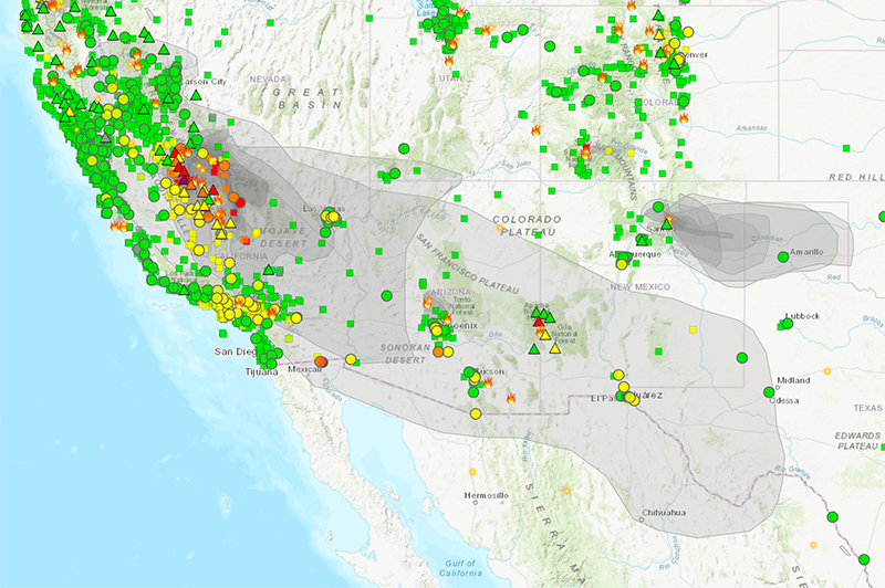
The website fire.airnow.gov is one that I have referred to many times the past due to the amount of fires in our area recently. I am heartened by the fact that most of the state is covered by green icons meaning any of these fires have been extinguished or completely contained. However, this website also displays the smoke covering any area of the United States and as I suspected we are in one of those smoky areas.

We may have to deal with smoke for a few more days but taking a look at the weather forecast for next week I see the rain is predicted soon. This will be a welcome change which will help to put out any remaining fires and clear the smoke in particulate matter from our air. It’s about time.